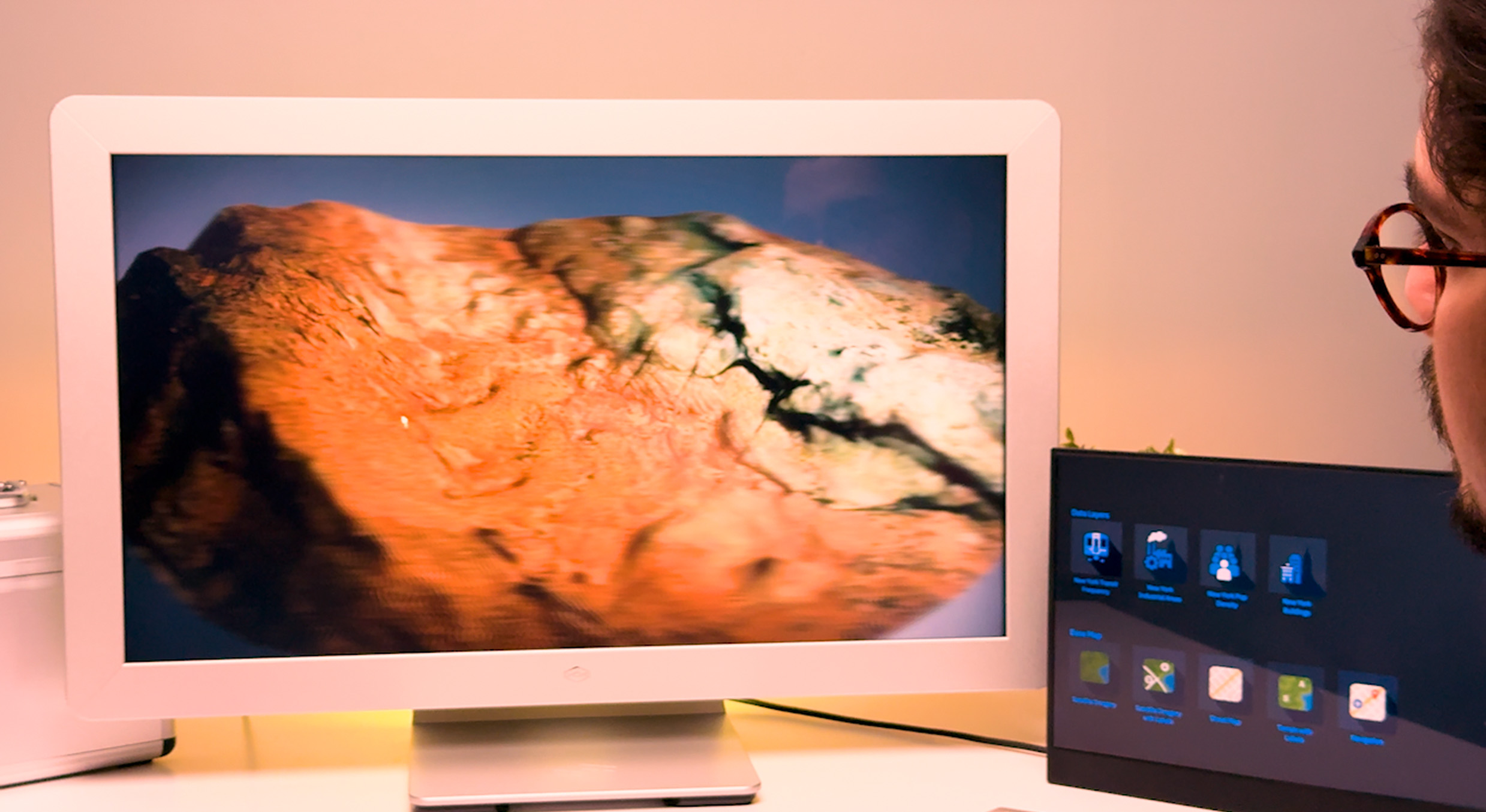
Stop viewing 3D data in 2D. Bring your ArcGIS maps, layers, and models to life with 3D depth.
Transform collaboration and decision-making with powerful 3D mapping and data visualizations.
Explore, present, and collaborate with your ArcGIS data, now with depth.
Present terrain, utilities, and built environments with depth your audience can see and understand.
Load your ArcGIS maps, scenes, and data layers for immersive 3D visualization.
Orbit, pan, and zoom through 3D content for dynamic, interactive exploration.
Control light direction and shadows to enhance clarity in 3D scenes.
Looking Glass
Looking Glass
Visualize and present your most important spatial data in true 3D.
To get started with the ArcGIS for Looking Glass solution, please contact our sales team.
We’re currently working closely with early adopters to understand their use cases and tailor the experience to their needs. Whether you're working with terrain, urban development, utilities, 3D buildings, vertical infrastructure, or underground assets — if you work with spatial data that can benefit from real 3D visualization, we want to hear from you.
Reach out to share your workflow, data, and goals — and we’ll help optimize the solution for your organization.
ArcGIS for Looking Glass is compatible with the Looking Glass 16” and the new Looking Glass 27” displays.
• The 16” is optimized for desktops, individual workstations, and smaller team reviews.
• The 27” is designed for larger group viewing, with 5K resolution and up to 16” of virtual depth for stunning detail and realism.
The system includes a Looking Glass 3D display (available in 16” or 27”) and a custom application designed to visualize ArcGIS maps, layers, and scenes in real 3D, without the need for headsets or specialized training.
It runs on GPU-equipped Windows machines and is built to support interactive exploration of spatial data, including terrain, infrastructure, and assets.
The ArcGIS for Looking Glass solution enhances your current ArcGIS Pro workflow by allowing you to view and interact with your existing GIS layers — including terrain, buildings, underground networks, and vertical infrastructure — in true 3D.
You can orbit, pan, zoom, and explore data in a more intuitive way, helping you and your stakeholders grasp spatial relationships faster and more clearly.
We're actively developing the application in collaboration with early adopters to ensure it delivers real value within professional GIS environments.
You can download the ArcGIS for Looking Glass application directly from the Looking Glass website.
Once installed, you can view included sample content or contact our sales team to discuss adding your custom ArcGIS layers and data.
Yes. You can bring in your own ArcGIS layers, scene layers, or integrated mesh data. To get started, please contact our sales team — we’ll work with you directly to configure your data for optimal 3D viewing on a Looking Glass display.
For optimal performance, we recommend a GPU-equipped Windows computer for running large datasets or complex 3D layers. See computer specs here.
The recommended PC requirements for using a Looking Glass Light Field display are as follows:
• CPU: 9th Gen i7 or equivalent
• Memory: Minimum of 16 GB RAMStorage: Minimum of 256 GB SSD
• Graphics: We recommend at least a NVIDIA GeForce RTX 2070 GPU
These specifications are recommended to ensure that the system can handle the high resolution and performance demands of the holographic display setup.
Contact our sales team to discuss pricing, configuration options, and how ArcGIS for Looking Glass can fit into your visualization workflow.
Looking Glass Factory offers a 30-day, no-questions-asked refund for any of our standard products you’re not satisfied with—provided the product is in its original, sellable condition. You can review the full policy here.
Sign up to receive ongoing updates about new product launches, events and announcements.